A Guide to MASW and ESPAC Surveys: Techniques, Equipment, and Software Solutions

Seismic surveys play a critical role in understanding subsurface structures, enabling industries ranging from urban infrastructure development to resource exploration to make informed decisions. Among the most widely adopted seismic methods are MASW (Multichannel Analysis of Surface Waves) and ESPAC (Extended Spatial Autocorrelation). These techniques are renowned for their effectiveness in surface wave analysis, allowing for precise mapping of underground layers and the identification of geological features.

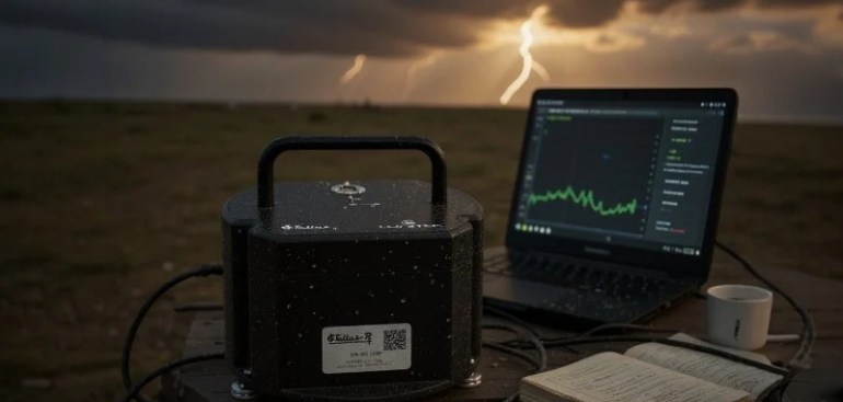
In this guide, we’ll explore MASW and ESPAC surveys, their methodologies, required equipment, and software solutions, including the advanced GN309 Intelligent Node Seismograph, a powerful tool for seismic exploration.

What is MASW (Multichannel Analysis of Surface Waves)?

Definition and Purpose

MASW is an Active Source Detection Method used to analyze Rayleigh surface waves generated by applying artificial vibrations to the ground. It is ideal for exploring shallow geological layers (less than 15 meters) and is commonly used in engineering, geotechnical assessments, and infrastructure monitoring.

How MASW Works

  1. Source Generation: Surface waves are generated using an active seismic source, such as a sledgehammer, weight drop, or vibroseis truck.
  2. Wave Propagation: The generated seismic waves travel through the upper soil layers, where their velocity is influenced by soil stiffness and density.
  3. Data Collection: An array of geophones (typically 12 to 48) placed at regular intervals records the seismic waves.
  4. Signal Analysis: Data from the geophones are processed using specialized software to generate dispersion curves and extract S-wave velocity profiles.

Applications of MASW Surveys

  • Urban Engineering: Assessing underground spaces and roadbed stability.
  • Pipeline Detection: Identifying potential hazards around buried pipelines.
  • Infrastructure Projects: Evaluating soil stability for bridges, buildings, and tunnels.
  • Site Characterization: Understanding the subsurface profile for construction planning.

Advantages of MASW

  • Effective for shallow layers (less than 15m).
  • Minimal environmental disruption.
  • Quick data collection and processing.
  • Provides detailed subsurface S-wave velocity profiles.

What is ESPAC (Extended Spatial Autocorrelation)?

Definition and Purpose

ESPAC is a Passive Source Detection Method that relies on natural ambient vibrations from the Earth’s surface. Unlike MASW, ESPAC does not require an external seismic source, making it ideal for mid-to-deep subsurface exploration (up to 10 km).

How ESPAC Works

  1. Passive Data Collection: Seismic sensors, typically geophones or broadband seismometers, are deployed to record ambient vibrations (from traffic, wind, or natural seismic activity).
  2. Autocorrelation Analysis: The recorded vibrations are processed using specialized software to create dispersion curves.
  3. Velocity Profile Generation: Data is interpreted to produce S-wave velocity profiles across various depths.

Applications of ESPAC Surveys

  • Resource Exploration: Mapping oil, gas, and mineral deposits.
  • Geological Research: Understanding fault zones and subsurface structures.
  • Deep Earth Monitoring: Studying deep geological formations for seismic resilience.
  • Hydrogeological Studies: Mapping aquifers and water-bearing strata.

Advantages of ESPAC

  • Ideal for deep subsurface analysis (up to 10 km).
  • Does not require active vibration sources.
  • Suitable for remote or hard-to-access locations.
  • Provides valuable insights into mid-to-deep geological structures.

Key Differences Between MASW and ESPAC

FeatureMASW (Active Method)ESPAC (Passive Method)
Source TypeArtificial (hammer, vibroseis truck)Natural (ambient seismic noise)
Depth RangeShallow (<15m)Mid-to-Deep (up to 10 km)
Data Collection TimeShortLong
Primary UseEngineering and shallow subsurface studiesResource exploration and deep geological mapping
Environmental ImpactMinimalNone

Equipment Required for MASW and ESPAC Surveys

1. Seismograph System

  • GN309 Intelligent Node Seismograph: A versatile, high-resolution data acquisition system with advanced 4G/WiFi connectivity and up to 30 days of battery life.
  • Geophones: Specialized seismic sensors (typically 2Hz or broadband geophones).
  • Seismic Source (For MASW Only): Hammer, weight drop, or vibroseis truck.

2. Data Acquisition Units

  • Systems capable of multi-channel data acquisition for synchronous sensor recording.
  • Rugged and portable hardware for field deployments.

3. Connectivity Tools

  • 4G and WiFi-enabled devices for real-time data transfer.
  • Remote monitoring and adjustment capabilities.

4. Data Processing Software

  • GeoTremors Professional Processing Software: A powerful platform for MASW and ESPAC data analysis, capable of real-time 2D/3D visualization, dispersion curve extraction, and HVSR analysis.
  • Features signal compensation and denoising algorithms for accurate results.

GN309 Intelligent Node Seismograph for MASW and ESPAC Surveys

The GN309 Intelligent Node Seismograph is the ideal tool for conducting MASW and ESPAC surveys.

Why GN309 is Ideal for MASW & ESPAC?

  • Precision: 2Hz geophone with 260 V/m/s sensitivity.
  • Extended Battery Life: Up to 30 days (normal mode) and 7–10 days (4G mode).
  • Expandable: Supports up to 3 additional components.
  • Portability: Lightweight and easy to deploy.
  • Connectivity: Real-time data transmission via 4G and WiFi.
  • Software Integration: Seamless operation with GeoTremors Professional Processing Software.

GeoTremors Professional Software for MASW & ESPAC

  • Real-time 2D/3D seismic data visualization.
  • Supports both active (MASW) and passive (ESPAC) surveys.
  • Advanced HVSR analysis and S-wave velocity profiling.
  • Signal processing algorithms for enhanced accuracy.
  • User-friendly interface for streamlined workflow.

Conclusion

Both MASW and ESPAC surveys are indispensable tools for seismic exploration, each catering to different depth ranges and geological objectives. With the GN309 Intelligent Node Seismograph and GeoTremors Professional Processing Software, professionals can ensure high-precision data acquisition, efficient processing, and reliable analysis across diverse environments.

👉 Order Your GN309 Now

For more information, contact QuakeLogic today:

Unlock deeper insights with MASW and ESPAC surveys powered by GN309 Intelligent Node Seismographevery vibration counts!

GN309 Intelligent Node Seismograph: Advanced Seismic Monitoring Made Simple

The GN309 Intelligent Node Seismograph is a state-of-the-art seismic acquisition system designed for surface wave detection and geophysical exploration. Combining precision hardware with advanced 2D/3D processing software, it ensures accurate, reliable, and real-time seismic data acquisition, even in the most challenging environments.

Whether it’s urban infrastructure projects, resource exploration, or seismic hazard monitoring, the GN309 provides the tools and performance needed to deliver actionable insights.

👉 Buy Now

Surface Wave Detection Method

Surface Wave Detection is a geophysical exploration technique that utilizes the wave dispersion characteristics of surface waves, primarily Rayleigh waves, to map subsurface layers. This method is categorized into two main approaches:

1. Active Source Detection (MASW)

  • What is it? A method using artificial vibrations to analyze shallow geological layers.
  • How it works: Vibrations from a hammer, weight drop, or vibroseis truck are recorded by geophones.
  • Applications: Ideal for studying shallow layers (<15m) in urban engineering, pipeline detection, and infrastructure projects.

2. Passive Source Detection (ESPAC)

  • What is it? A method relying on natural ground vibrations for deep-layer analysis.
  • How it works: Ambient vibrations are recorded and analyzed to determine S-wave velocity structures.
  • Applications: Suitable for deep strata exploration (up to 10 km), including mineral resource detection and oil reservoir mapping.

These complementary techniques offer a comprehensive understanding of subsurface structures, essential for reliable seismic assessments.

Click HERE for our BROCHURE to learn more about its use cases for MASW and ESPAC surveys.

Click HERE for the DATASHEET.

Key Features of the GN309 Seismograph

High-Precision Data Acquisition

  • Built-in 2Hz geophone with 260 V/m/s sensitivity.
  • Ultra-accurate 32-bit ADC for minimal noise interference.
  • 5s–200Hz bandwidth for comprehensive frequency coverage.

Extended Battery Life

  • Operates up to 30 days in normal mode.
  • Provides 7–10 days of uninterrupted performance in 4G mode.

Compact & Portable Design

  • Dimensions: Φ125mm × H165mm (without cone).
  • Lightweight build (<1.6 kg) for easy deployment in remote areas.

Expandable System

  • Connects up to 3 additional external components for enhanced functionality.

Reliable Connectivity

  • Integrated 4G and WiFi support for real-time data transmission.

Versatile Compatibility

  • Adapts to various seismic sources for diverse applications.

Rugged Build for Field Deployment

  • Durable and weather-resistant design ensures reliable performance in harsh conditions.

Applications of the GN309 Intelligent Node Seismograph

1. Engineering Exploration:

  • Urban underground space mapping
  • Roadbed boulder detection
  • Urban drainage pipeline assessments
  • Detection of engineering cracks

2. Resource Exploration:

  • Aquifer and lithology mutation studies
  • Coal, oil, and gas exploration

3. Structural Exploration:

  • Karst formations and fault fracture zones
  • Collapse column identification
  • Real-time monitoring of overburden thickness

4. Seismic Monitoring:

  • Volcano activity monitoring
  • Microseismic monitoring
  • Earthquake detection and localization
  • Earthquake early warning systems

The GN309 is a versatile tool for engineering, resource, structural, and seismic monitoring, delivering clear, actionable data across a range of professional applications.

GeoTremors Professional Processing Software

The GN309 seamlessly integrates with GeoTremors Professional Processing Software, empowering seismic professionals with advanced analysis capabilities:

  • Supports active (MASW) and passive (ESPAC) surveys.
  • Provides real-time 2D/3D data visualization.
  • Features signal compensation and denoising algorithms for enhanced accuracy.
  • Enables HVSR (Horizontal-to-Vertical Spectral Ratio) analysis for subsurface profiling.
  • Calculates Vs30 and Vs100 values for precise geological mapping.

This intuitive software ensures fast and accurate data interpretation, streamlining seismic survey workflows.

Why Choose the GN309 Intelligent Node Seismograph?

  • Easy Setup: Compact, lightweight, and ready for deployment.
  • Long Battery Life: Up to 30 days of continuous operation.
  • High-Precision Data: Clear and noise-free measurements.
  • Flexible Configuration: Supports additional sensors and extensions.
  • Real-Time Connectivity: Reliable 4G and WiFi data transfer.
  • Advanced Software Integration: Includes GeoTremors 2D/3D analysis tools.

The GN309 offers a perfect balance of precision, durability, and flexibility, making it the preferred choice for seismic professionals worldwide.

👉 Order Your GN309 Now

About QuakeLogic

QuakeLogic is a global leader in seismic monitoring solutions, offering innovative technologies for accurate seismic data acquisition and analysis. Our solutions empower organizations worldwide to predict, understand, and mitigate seismic risks effectively.

For more information or inquiries, reach out to our sales team today.

The GN309 Intelligent Node Seismograph is your ultimate solution for precise, reliable, and efficient seismic monitoring, delivering results you can trust—every vibration counts.

Geobox: Revolutionizing Geotechnical Testing on Shake Tables

In the dynamic world of geotechnical engineering, precision, reliability, and adaptability are key to uncovering insights that drive innovation and safety. Geobox by QuakeLogic stands at the forefront of engineering excellence, meticulously designed to enhance the testing capabilities of shake tables for geotechnical research and experimentation.

Simulating Critical Geotechnical Phenomena

Geobox is engineered to simulate and analyze key geotechnical phenomena, empowering engineers and researchers to study complex soil-structure interactions under controlled seismic conditions. Its advanced design allows detailed testing of:

  • Liquefaction: Understanding how saturated soils lose strength during seismic events.
  • Lateral Spreading: Evaluating soil displacement caused by ground shaking and slope instability.
  • Slope Stability: Assessing the resilience of soil slopes under dynamic loading.

These capabilities make Geobox an essential tool for validating geotechnical models, advancing research, and improving infrastructure resilience in seismic-prone regions.


Seamless Integration with Shake Tables

A standout feature of Geobox is its compatibility with a wide range of shake tables offered by QuakeLogic. Whether for small-scale academic experiments or large-scale infrastructure projects, Geobox integrates effortlessly with various shake table systems.

Its easy-mount hardware simplifies setup, reducing time and effort required for deployment. Engineers can focus on their experiments without being bogged down by technical constraints, ensuring a seamless workflow from setup to data acquisition.


Customization for Project-Specific Needs

At QuakeLogic, we understand that no two projects are the same. That’s why the Geobox’s size can be fully customized to meet specific experimental requirements. Whether you’re simulating liquefaction on a small soil column or analyzing slope stability across a large soil mass, Geobox adapts to deliver accurate and reliable results.

This customization empowers researchers to align their testing processes with their project objectives, ensuring outcomes that are both meaningful and actionable. QuakeLogic produces Geobox in custom dimensions, from small-scale to large-scale configurations. Contact us today for a customized quotation.


Robust and Reliable Design

Built to withstand rigorous testing environments, the Geobox’s robust construction ensures durability and repeatability across multiple test cycles. Researchers can trust its performance, even under the most demanding experimental conditions, making it a valuable asset in both academic research labs and industry testing facilities.


Driving Innovation in Geotechnical Engineering

Geobox by QuakeLogic isn’t just a piece of equipment—it’s a gateway to innovation. By enabling detailed analysis of soil behavior under seismic stress, it empowers researchers and engineers to develop safer, more resilient infrastructure solutions.

With its versatility, precision, and robust design, Geobox is setting new standards for geotechnical testing, offering unparalleled value to educational institutions, research facilities, and industry partners worldwide.

Seeing is Believing! Experience the power of Geobox firsthand and discover how it can transform your geotechnical testing processes.

Contact QuakeLogic today to learn more about how the Geobox can be tailored to meet your project needs and drive your research forward. Visit GEOBOX product page by clicking HERE.

Proudly Made in the USA.

At QuakeLogic, we don’t just deliver products—we deliver solutions.

About QuakeLogic

QuakeLogic is a leading provider of advanced seismic monitoring solutions, offering a range of products and services designed to enhance the accuracy and efficiency of seismic data acquisition and analysis. Our innovative technologies and expert support help organizations worldwide to better understand and mitigate the impacts of seismic events.

Contact Information

Email: sales@quakelogic.net
Phone: +1-916-899-0391
WhatsApp: +1-650-353-8627
Website: www.quakelogic.net

For more information about our products and services, please visit our website or contact our sales team. We are here to help you with all your seismic monitoring needs.